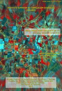


Serie Correlación Geológica 33
Craters in the Telsen area, Chubut Province, Argentina: Satellite imagery digital processing techniques applied to surficial geology mapping
Ricardo Astini | Martín Cano | María Julia Orgeira | Claudia Prezzi | Edgardo Navarro
Descargar trabajo en formato PDFResumen
CRÁTERES EN EL ÁREA DE TELSEN, PROVINCIA DE CHUBUT, ARGENTINA: TÉCNICAS DE PROCESAMIENTO DIGITAL DE IMÁGENES SATELITALES APLICADAS AL MAPEO GEOLÓGICO DE SUPERFICIE. En cercanías de la localidad de Telsen, NE de Chubut, se reconocieron rasgos subcirculares, con morfología de cráteres, desarrollados en un contexto volcano-sedimentario con un diámetro que no superan los 2 km. Estas estructuras, rodeadas por rocas volcánicas tabulares con bajo buzamiento radial centrífugo de la Fm. Quiñelaf, presentan un anillo externo con niveles visuales oscuros que encierra en su interior altos topográficos caracterizados por niveles visuales mayoritariamente claros. Se desarrolló un mapeo de detalle, a escala 1:3.000, de una de las estructuras mayores reconocidas (S 42° 22’ 55’’, W 66° 49’ 15’’), empleando imágenes satelitales y siguiendo las pautas propias de la fotointerpretación. Se utilizaron bandas de imágenes pancromática y multiespectral de Spot y ventanas de imágenes Google Earth de 0.5 m de resolución espacial. Los software Idrisi, Global Mapper, StitchMaps y Corel Draw fueron empleados para el tratamiento digital de las imágenes. Las referencias geológicas del área fueron consideradas a partir de la Hoja Geológica Telsen, georreferenciada con Global Mapper. Histogramas de distribución de frecuencias de ventanas de imágenes de los sectores mapeados, permitieron realizar distintos realces de contraste. Filtros direccionales del menú texture analysis de Idrisi facilitaron el reconocimiento de rasgos. Las imágenes así obtenidas, posibilitaron la delimitación de unidades homogéneas en términos de caracteres de observación directa, vinculadas con la etapa de fotoanálisis. El ajuste y asignación final de categoría de cada unidad homogénea (etapa de fotointerpretación final), se realizó con posteriores observaciones de campo. El mapa final se desarrolló con el software Corel Draw a partir de la imagen resultante de síntesis del procesamiento digital, georreferenciado posteriormente con Global Mapper. Se delimitaron afloramientos y fragmentos de basaltos que constituyen un anillo externo y encierran fragmentos de volcanitas de diferente composición, brechas y fragmentos del Grupo Chubut esparcidos en toda la superficie. En la parte centro-sur, se destacan afloramientos de volcanitas y fragmentos y estratos buzantes del Grupo Chubut cuyo rumbo tiende a acompañar al rumbo del anillo. Estudios geofísicos de detalle, permitieron reconocer dos anomalías magnéticas en el sector SE. Diversos mecanismos como magmatismo, freatomagmatismo y/o impacto de bólidos constituyen hipótesis relacionadas al probable origen de estas geoformas.
Abstract
Subcircular features, with crater morphology, developed in a volcano-sedimentary context, with diameters no greater than 2 km, were recognized in the vicinity of the Telsen locality, northeastern Chubut Province, Argentina. These structures are surrounded by tabular volcanic rocks of the Quiñelaf Formation with low radial-centrifugal dip, exhibit an external ring with dark visual levels enclosing topographic highs with mostly light visual levels. Surficial geological aspects of one of the larger structures in the area (S 42° 22’ 55’’, W 66° 49’ 15’’) were mapped from raster data at a scale of 1:3.000, following the stages of
the photographic interpretation. Panchromatic and multispectral Spot images, and Google Earth image
with 0.5 m. spatial resolution were used. Idrisi, Global Mapper, StitchMaps and Corel Draw software were used in the digital processing. The geological references of the area were obtained from the Telsen Geological map, herein georeferenced with Global Mapper. The frequency distribution histograms of the image windows of the different mapped sectors, allowed the generation of different contrast enhancements. Directional filters of the menu texture analysis of Idrisi permitted the identification of the oriented features. The images obtained herein, allowed the recognition of homogeneous units in terms of interpretation keys linked to the photo-analysis phase. Subsequent field observations contributed to the adjustment and to the final assignment of categories to each homogeneous unit (photo-interpretation last stage).The final map was compiled with the software Corel Draw, it was based on the synthesis image from the digital
processing and referenced using Global Mapper. Deposits and fragments of basalt that constitutes the external ring of the crater along with different volcanic rocks, breccia and Chubut Group rocks fragments enclosed within the crater are mainly showed in this map. Also, deposits and dipping strata of the Chubut Group following the strike of the ring and outcrops of volcanic rocks in the central - south part of the mapped area were recognized. Detailed geophysical surveys detected magnetic anomalies in the SE part of the mapped crater. Several mechanisms such as magmatism, phreatomagmatism and/or bolide impacts
constitute hypotheses related to the probable origin of these landforms.