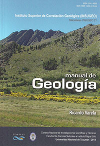
Miscelánea 21
Primeras Páginas
Descargar trabajo en formato PDFResumen
l planeta acorde con el conocimiento actual.
En sucesivos capítulos se ocupa luego de los materiales componentes de la Tierra, minerales (Mineralogía), rocas (Petrología) y las estructuras que adquieren ante los esfuerzos aplicados por la dinámica del planeta (Tectónica). Trata también el ordenamiento de los cuerpos que definen las rocas, la Estratigrafía y Cronología, que posibilita un seguimiento de los eventos ocurridos o Geología Histórica. El Mapa Geológico es descripto como el resultado de la tarea de campo y la representación a escala adecuada de unidades rocosas y sus estructuras, con énfasis en la identificación de Provincias Geológicas en territorio argentino. Finalmente incluye una breve descripción de la aplicación de la geología en asuntos de interés económico, como suelos, aguas subterráneas, minerales, hidrocarburos, grandes obras de ingeniería, riesgo geológico y geología ambiental.
Abstract
This handbook contains in first place few essential data about the Earth, which is the study object of Geology. This includes its dimensions, internal organization determined by geophysical studies, characteristics and significance of continents and oceans on its surface, surface relief and movements that tend to balance continental heights and oceanic depths. Then comes the fundamental basis on which the theory of Global Tectonics is supported to explain the evolution of the planet.
Successive chapters deal with the materials making up the Earth, such as minerals (Mineralogy) and rocks (Petrology), as well as the structures acquired by the rocks as a response to stresses originated in geodynamic processes in the Earth (Tectonics). They also consider the systematic ordering of rock units in relation to Stratigraphy and Geochronology, which allows the succession of events to be revealed (Historical Geology). Geological maps are described as a final product of field mapping, where rock units and their structures are represented at different scales. The identification of Geological Provinces in our country receives special attention. Lastly, short descriptions are added on the application of geology to areas and issues of economic interest, such as soil, groundwater, minerals, hydrocarbon, large engineering projects, geological risk and environmental geology.


