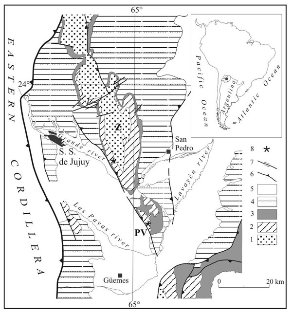
Figure 13. Geology and location map of the Zapla Range. 1, Ordovician undifferentiated; 2, Zapla Formation (Upper Ashgill); 3, Lipeón Formation (Silurian); 4, Mendieta Formation (Lower Devonian); 5, Salta Group (Cretaceous – Tertiary); 6, Tertiary undifferentiated; 7, Quaternary; 8, outcrops; 9, fault; 10, anticline; 11, fossiliferous locality.
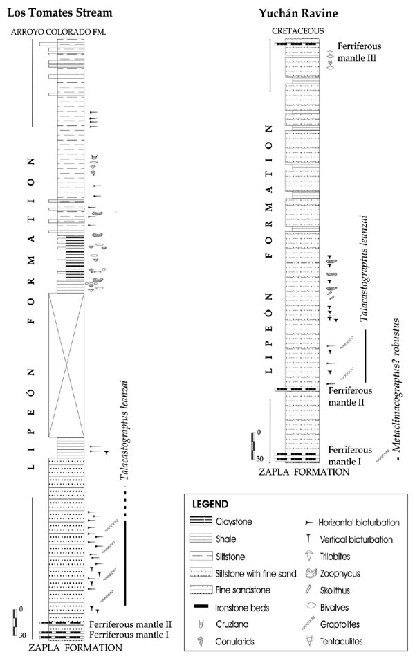
Figure 14. Stratigraphic columns of the Zapla and Puesto Viejo ranges (after Rickards et al., 2002).
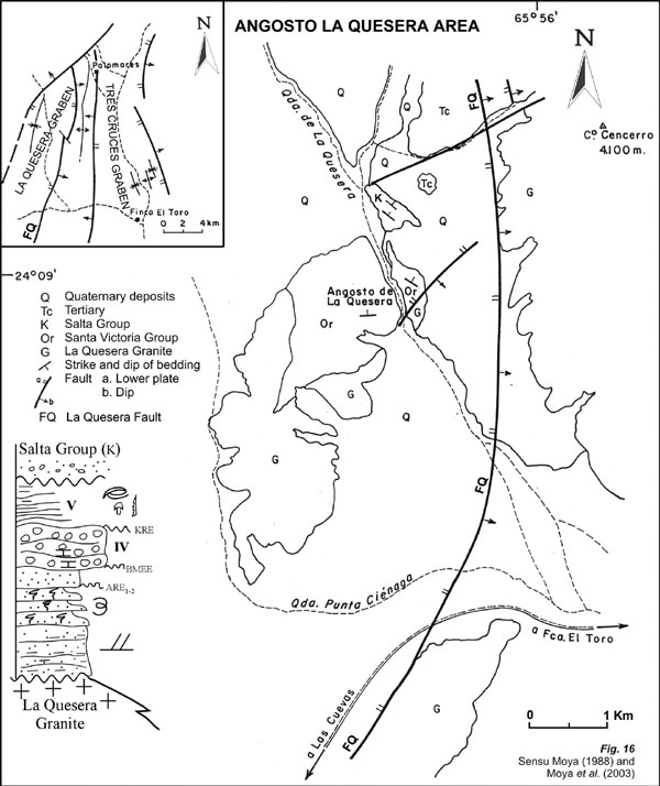
Figure 16. Geological and location map of the Agua Blanca area
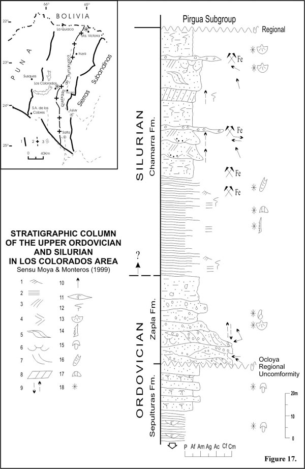
Figure 17. Location map and stratigraphic column of Zapla and Chamarra formations of the Los Colorados area: 1, wavy bedding. 2, parallel lamination. 3, low angle planar lamination. 4, herringbone. 5, sigmoidal boundles. 6, trough. 7, tangential lamination. 8, inclined heterolitic stratification. 9, positive or negative gradation. 10, paleocurrents. 11, coquina. 12, bioturbation. 13, brachiopod. 14, graptolite. 15, trilobite. 16, cephalopod. 17, ostracod. 18, fossiliferous levels.
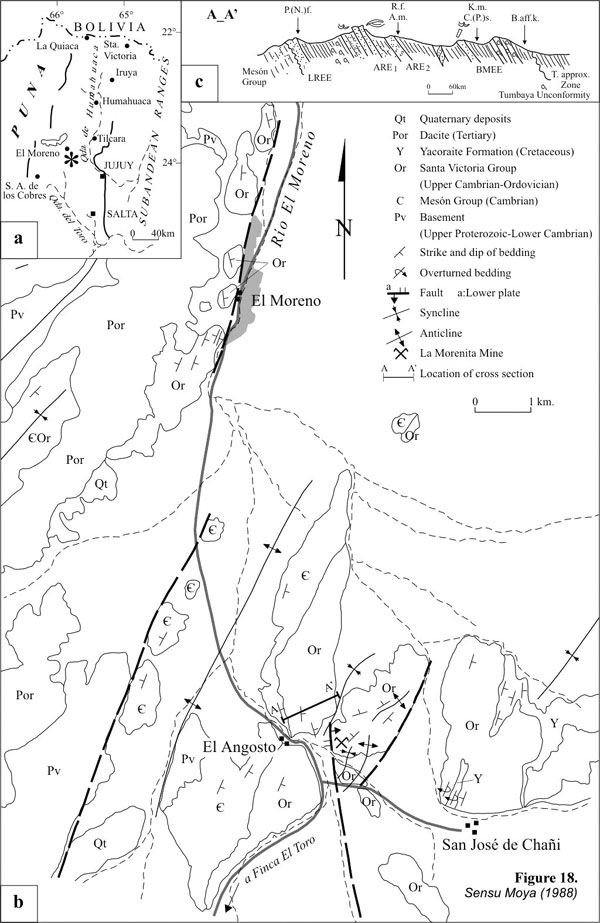
Figure 18. a. Location map. b. Geologic map. c. Profile of the Upper Cambrian –Tremadocian deposits of the Angosto del Moreno area.
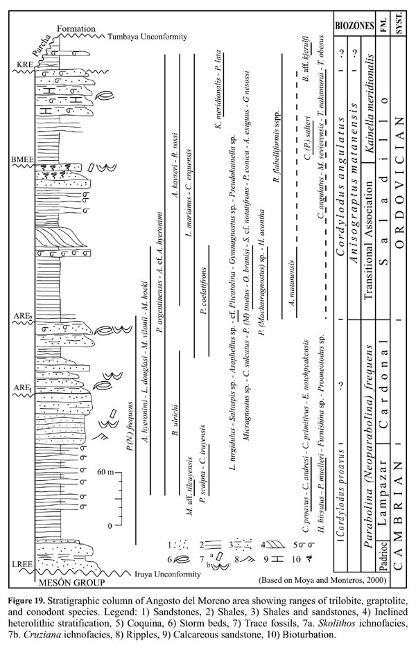
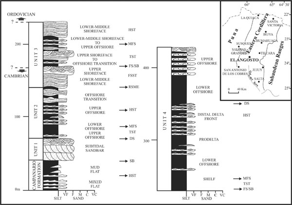
Figure 20. Location map and stratigraphic log of the Upper Cambrian–Tremadocian succession at Angosto del Moreno. TST, transgressive systems tract. HSST, highstand systems tract. FSST, falling stage systems tract. SB, sequence boundary. DS, drowning surface. RSME, regressive surface of marine erosion. FS/SB, amalgamated sequence boundary and flooding surface. (after Buatois et al., 2003).